At the far north of Scotland lies the most north-westerly point in mainland Britain, Cape Wrath. This wild and remote headland is both beautiful and challenging, but for those who visit it is an unforgettable experience.
The road to Cape Wrath
Here was the challenge:
- Was it possible to walk solo around Cape Wrath self-supported in three days?
- Was it possible to only use public transport?
- Was the experience going to be worth it?
Happily, the short answer to all three of those questions is, yes!
Public transport was the first step as everything else would have to fit in around it. Thankfully the brilliant Far North Bus has a service in the summer months running north to Keoldale, the crossing point for the Cape Wrath Ferry, on the Friday and one south from Kinlochbervie on the Monday.
It’s a great service where you book in advance and the driver will drop you off in locations less visited by other transport options, like Durness at the north coast of Sutherland. They’re also used to lots of hikers and cyclists heading for Cape Wrath so no need to worry about your gear being a problem.
Cape Wrath headland
Once I’d booked my bus it was time to look at what I’d need to take with me. I figured three days would give me ample time to make the distance and decided to wild camp for all three of the nights. Bear in mind that there is a section in the Scottish Outdoor Access Code on responsible wild camping.
Scroll down to the end of the blog if you’d like to view my kit list for the weekend. It turned out that I didn’t need any of my wet weather gear but I felt better for having packed it considering how quickly weather in the Scottish Highlands can turn.
Day 1 - Lairg > Keoldale (near Durness) > Kearvaig Bothy (Cape Wrath Headland)
Hopped on the bus in Lairg and enjoyed a lovely scenic drive north while getting a great chat with the bus driver. He’s just recently moved north and is loving the community aspect of rural life!
When I ask if he’s able to drop me off at the Keoldale road end, despite it not being an official stop, there’s absolutely no problem. And in the meantime we make a quick stop to deliver a local’s shopping. The bus is a lifeline for the remote communities in Durness and the north and it’s great to see and hear how they’ve supported their communities during COVID-19.
Once I arrive at Keoldale it’s a short walk to the passenger ferry point where the local ferryman has just arrived back from delivering his last visitors across the Kyle. I offer to wait until more visitors arrive but he spots a couple of cyclists waiting to be ferried back to Keoldale so off we go.
Cape Wrath foot ferry crossing back to Keoldale
The foot ferry runs on a system that it goes when someone’s there, and it doesn’t go if someone’s not there. More sensible than having a timed or booking system considering so much depends upon the tides and the weather, not to say anything of the rural winding roads that visitors have to navigate before they even arrive.
But I had phoned up in advance to double check that he would be running that day and he had been more than happy to answer my questions. He was just as happy to answer my questions while on the ferry and it just goes to show that the locals always have the best information and advice.
If you were looking to visit Cape Wrath but not on foot or bicycle then there is the option to take a minibus on what I’m told is an exciting and rickety ride. However, this was the point where I shouldered my rucksack and took off on foot, enjoying the slower pace and the opportunity to take in some stunning scenery.
Keoldale to Kearvaig
As you approach the north you come across the barrier delineating the Cape Wrath Firing Range. It’s important to check online whether the range will be active or not before planning any travels if your ambition is to make it to the tip of the headland.
Having checked in advance I was pretty certain that there would be no issues so carried on happily, with slightly sorer feet than when I’d started, until I reached Kearvaig bothy in the early evening.
Kearvaig Bothy
I’d known of Kearvaig for some years beforehand and was desperate to visit and stay the night. It is possible to stay in the bothy itself, which is maintained by the fantastic Mountain Bothy Association, but given that COVID-19 was still a concern I chose to camp outside, which was even better given the excellent weather and stunning sunset!
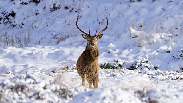
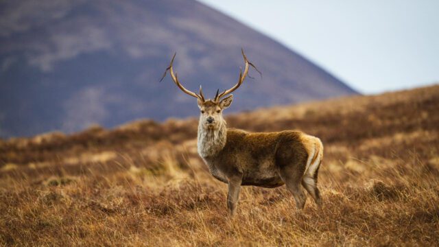
Deer at Kearvaig and Kearvaig Beach sunset
Day 2 (Cape Wrath Headland) - Kearvaig Bothy > Cape Wrath Lighthouse > Sandwood Bay
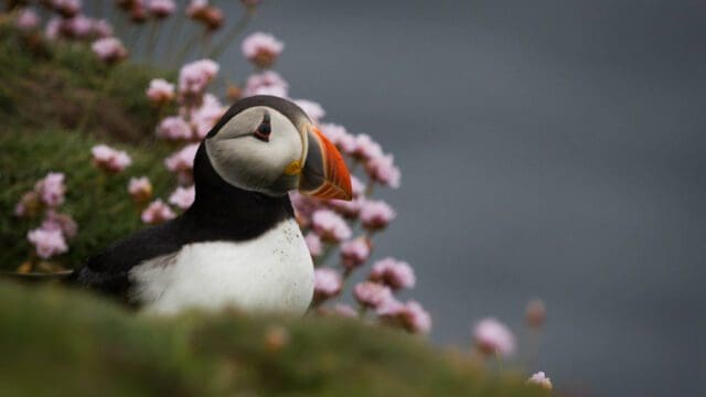
After breakfast and packing up camp there was time to pop up the nearby cliffs to enjoy gorgeous views of the beach and bothy, as well as say hello to some local bird life. And then it was off on the rambling track once again to Cape Wrath Lighthouse, the most north-westerly lighthouse on the British mainland.
Sunny morning at Kearvaig
The lighthouse was built in 1848 as a necessary beacon to ward ships away from the precipitous headland on dark and stormy nights. With no other lights for miles around it’s unsurprising that there were so many wrecks before the erection of the lighthouse.
Now of course it is unmanned, but it is not unpeopled!
Once you’ve taken your share of the views and carefully explored around the cliffside you can visit the Cape Wrath café in one of the old lighthouse outbuildings and enjoy a hot drink and maybe even a bit of home baking.
The brownies are heavenly. Don’t resist!
Cape Wrath Lighthouse
Refuelled and ready to go again this was the point where I would leave the rough road and take off into the wild. You have to double back on yourself slightly from the lighthouse and there is no marked path so this route should only be taken if you are confident in your navigation skills with a map and compass.
This route is known as the Cape Wrath Trail and I was walking on the very start of it. It ranges from Cape Wrath Lighthouse all the way down the west coast to Fort William and is considered the most challenging long-distance route in Scotland. It also hosts the Cape Wrath Ultra Challenge which is an 8 day endurance race the length of the Cape Wrath Trail.
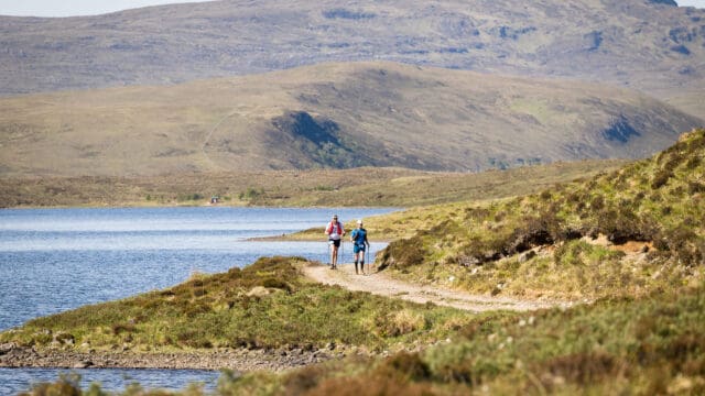
Choosing the cliff route, rather than inland, meant I had a slightly longer walk with more elevation, but the views alone were more than worth it and with warm sunshine on my head and a cool breeze to wave me on I had a beautiful walk down the coast to nearby Sandwood Bay.
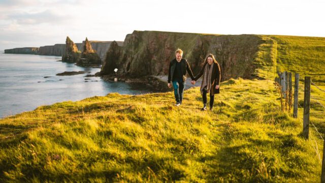
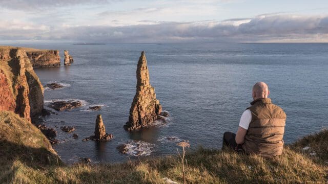
Cliff side route on the Cape Wrath Trail
Coming over the hill and seeing Sandwood beach gleaming in the distance for the first time felt incredible. There’s nothing quite like the scenery in Scotland and there’s something special about standing on top of a hill taking it all in.
Sandwood at a distance
That night I had a perfect campsite all to myself at the northern end of Sandwood Bay. As I watched the sun set, and warded off a few aspiring midges, I felt it couldn’t get better than this.
Sunset at Sandwood
Day 3 - Sandwood Bay > Blairmore > Kinlochbervie (north-west Sutherland)
The next morning finished the trek to Sandwood beach proper and I got to enjoy strolling in the sand watching the waves crashing on the beach as Am Buachaille looked on. A spot of sunshine made everything glow and it was easy to imagine that this place must have been visited and loved by people for thousands of years.
Sandwood Beach and Am Buachaille
The John Muir Trust currently look after the area of Sandwood Bay, including the dunes and loch, and their efforts are obvious with the great work being done to maintain pathways and provide information on the site. As a delicate natural habitat it is important to enjoy the stunning beach and dunes, but also to protect them for the future.
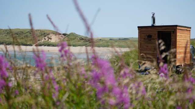
Sandwood Beach, dunes and path
Leaving the beach by the main walking route meant running into more people in the space of half an hour than I had seen all weekend! But it was wonderful to say hello to them and imagine what their stories were and why they had chosen to come to this remote place.
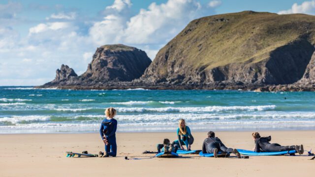
One pair in particular were determined to reach the beach with their surfboards and I had to admire their effort, while they probably looked at my sweaty and tired face and wondered how far they had to go.
Coming closer to Kinlochbervie meant more cars and more people, but my campsite that night high above the village felt nearly as remote as the first two nights in that wild and beautiful landscape. As part of the North West Highlands Geopark you would expect the geology of the area to be interesting but I honestly felt I could have happily gotten lost in all the rugged beauty that surrounded me.
My only regret was not taking the longer coastal route by Sheigra, Polin and Oldshoremore beaches! But sometimes you have to leave yourself something to enjoy for the next time you go back.
Day 4 - Kinlochbervie > Lairg
One last breakfast and camp clear up and it was off into Kinlochbervie to catch the Far North bus back to Lairg. Upon hopping into the cab I looked around and laughed to myself at all the inhabitants gently snoozing behind me, surrounded by bags, bikes and everything else you could imagine from an adventurous weekend away.
Then I closed my eyes and enjoyed a warm nap all the way home.
Dreaming of Sandwood
Kit List
Tent – This goes without saying when wild camping unless you choose to bivvy.
Sleeping mat – Not just great for comfort but also to insulate you against the ground and keep you warm.
Sleeping Bag – I happen to sleep very cold so I often take two with me, you might think it excessive but far better to be comfortable with a few luxuries if you’re not in a rush.
Sleeping bag liner – This one I wouldn’t consider essential, but it helps again with warmth and stops your sleeping bag from getting too smelly.
Sleeping clothes – General rule of thumb you have one set of clothes for walking and one set of clothes for sleeping, blissful if you’ve been walking all day in the wet and are looking forward to snuggling up in some dry clothes at night!
Walking clothes – See above, but be prepared for the reverse horrible situation of knowing that you’ll have to change out of those nice dry sleeping clothes into your soggy wet walking clothes the next day.
Walking boots/shoes – It’s personal preference as to what you use. I have a pair of sturdier boots that I wear when carrying heavy loads to save my ankles a little.
Walking poles – Takes you from two wheel to four wheel drive on your adventures! Whether you are young or old a pair of poles can make all the difference to your walk. Always use two poles to keep yourself balanced.
Cooking equipment – I always use a camping stove with a simple pot. Don’t light any campfires while wild camping.
Rain gear – I usually always take with me when camping unless the weather forecast looks set to be blazing sunshine, but a waterproof jacket and trousers can also be a great wind break if there’s a stiff breeze.
Toileting supplies – Current advice is to bag and bin everything. It’s not weird, just get yourself some good thick bags and you’ll be fine.
Water purification – There’s several different methods depending on your preference but I carried a simple water filter with me and refilled at running burns and streams.
Food – Enough to last you the time you expect to be out and a little extra just for emergencies. There’s no need to load yourself down with tonnes of food but it doesn’t hurt to have a few treats to look forward to, sometimes they’re just what you need to get you through a rough patch of walking.
Navigation equipment – It’s always best to travel with a physical map and compass and know how to use them. You may not even need to look at a map on a given day but better to be safe than sorry.
Phone – It’s always the right decision to take a communication device with you, you never know when you may need to use it for yourself or someone else! If you’re walking in a wild area you’ll need to ring 999, ask for the police and then mountain rescue for help.
Miscellaneous
- Small first aid kit + emergency bivvy sack
- Spare toastie jacket
- Headtorch
- Midge repellent
- Sunscreen
- Buff
- Sunglasses
- Extra socks
- Camp slippers/flip flops
- Toothbrush
- Book for night time reading
Rachel Paterson
Venture North
Read next
Walking in the Wild
Top Tips to Safely Explore and Enjoy Caithness and Sutherland – by Sue Agnew of Assynt Mountain Rescue Team
click herePhotos on this page by Rachel Paterson.